一直想调用一下地图API接口什么的,刚好遇到了这个实验就浅浅研究写了一下,顺便总结一下给其他没太了解的人一点便利,希望能够对你有所帮助~
如何引入、配置、使用、显示。
PS:要是嫌麻烦想要源码/有什么问题欢迎评论/私信,问题的话我很愿意回答,但是源码的话不接受白嫖哦~(搞出来都是需要时间和精力的)
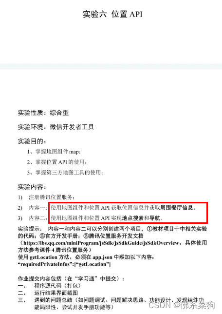
零、任务
1.要求
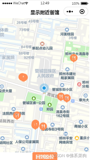
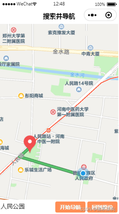
2.成果
一、准备工作
1.相关官方文档
微信小程序JavaScript SDK | 腾讯位置服务
map | 微信开放文档
2.腾讯地图API前置步骤
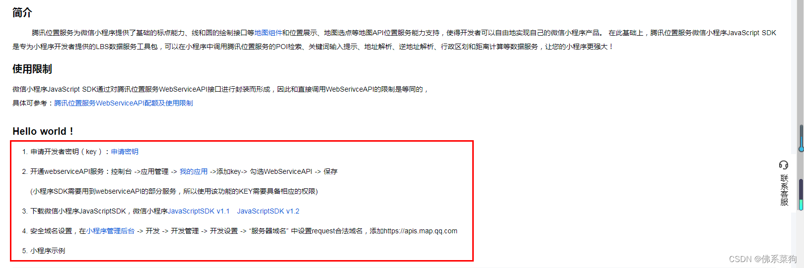
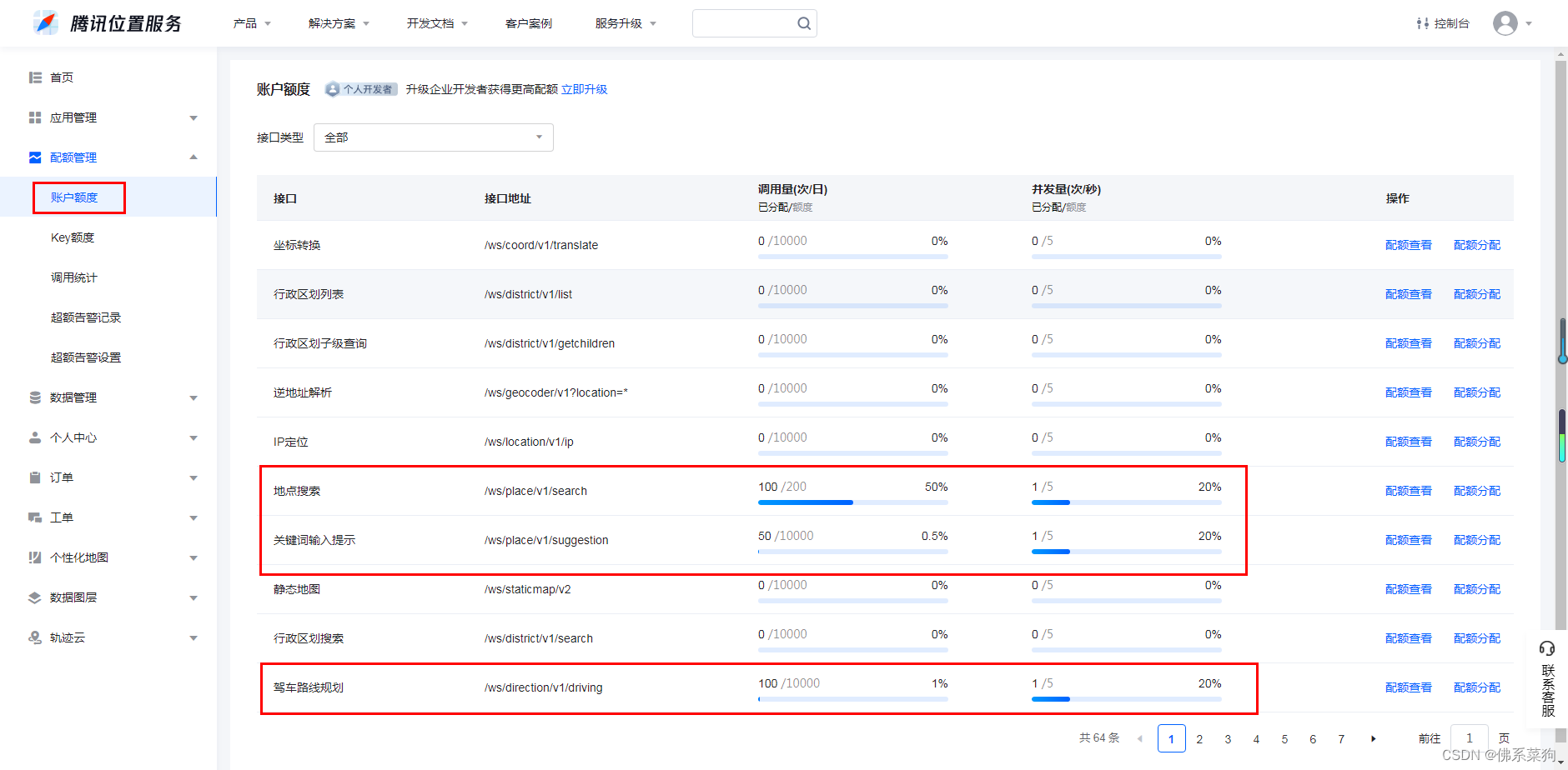
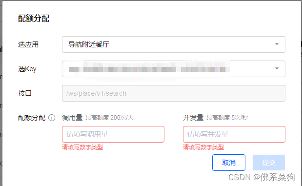
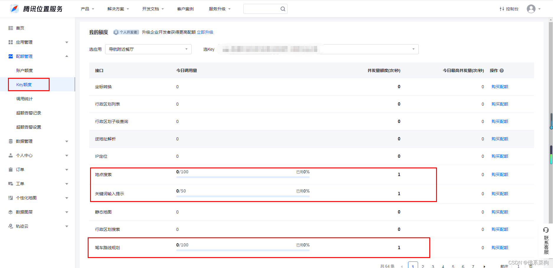
其中,申请Key后记得点击“配额分配”配置需要使用的腾讯地图服务API。
(使用次数超出配额后需要增加配额才能继续使用)
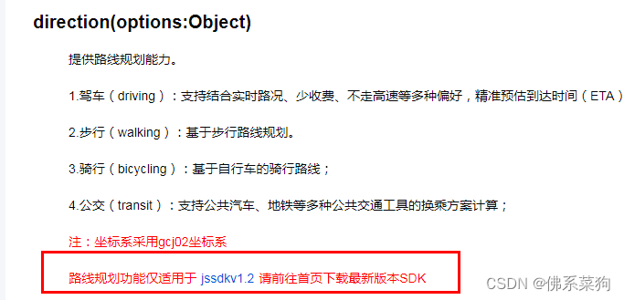
以及建议下载使用 JavaScriptSDK v1.2
二、使用腾讯地图API
例子:地点搜索API的使用
// 引入SDK核心类,js文件根据自己业务,位置可自行放置
var QQMapWX = require('../../libs/qqmap-wx-jssdk.js');
var qqmapsdk;
Page({

    onLoad: function () {
        // 实例化API核心类
        qqmapsdk = new QQMapWX({
            key: '申请的key'
        });
    },
    onShow: function () {
        // 调用接口
        qqmapsdk.search({
            keyword: '酒店',
            success: function (res) {
                console.log(res);
            },
            fail: function (res) {
                console.log(res);
            },
        complete: function (res) {
            console.log(res);
        }
     });
  }
})
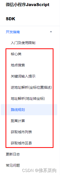
其他API的使用,可以直接到官方文档查阅。
微信小程序JavaScript SDK | 腾讯位置服务
三、将查询结果显示在小程序页面
可以使用微信小程序中的map组件进行数据显示,下面是map组件的官方文档。
map | 微信开放文档
另:
上述都是使用封装WebService后的JavaScriptSDK v1.2进行接口的调用,也可以直接使用原生wx.request()发送请求。(两者相较显示都一样,就是调用API写法略不同)
wx.request({
  url: '接口url',  //仅为示例,并非真实的接口地址
  data: {
    x: '',
    y: ''
  },
  header: {
    'content-type': 'application/json' // 默认值
  },
  success (res) {
    console.log(res.data)
  }
}
官网有更加详细完整的例子可以进行参考,方便小白理解和使用。
WebService API | 腾讯位置服务
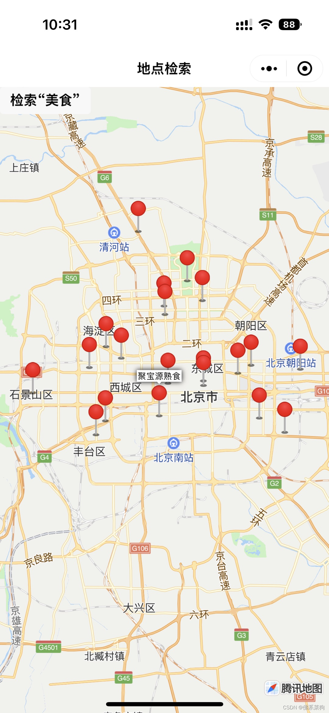
示例1:地点搜索
index.wxml
<!--index.wxml-->
<view class="container">
  <map id="map"
    class="map"
    markers="{{markers}}"
    longitude="{{longitude}}" latitude="{{latitude}}">
  </map>
</view>

<button size="mini" bindtap="buttonSearch">检索“美食”</button>
index.js
// index.js
// 获取应用实例
const app = getApp()

Page({
  data: {
    latitude: 39.909088,
    longitude: 116.397643
  },

  buttonSearch(e){
    var _this = this
    var allMarkers = []
    //通过wx.request发起HTTPS接口请求
    wx.request({
      //地图WebserviceAPI地点搜索接口请求路径及参数(具体使用方法请参考开发文档)
      url: 'https://apis.map.qq.com/ws/place/v1/search?page_index=1&page_size=20&boundary=region(北京市,0)&keyword=美食&key=您的key',
      success(res){
        var result = res.data
        var pois = result.data
        for(var i = 0; i< pois.length; i++){
          var title = pois[i].title
          var lat = pois[i].location.lat
          var lng = pois[i].location.lng
          console.log(title+","+lat+","+lng)
          const marker = {
            id: i,
            latitude: lat,
            longitude: lng,
            callout: {
              // 点击marker展示title
              content: title
            }
          }
          allMarkers.push(marker)
          marker = null
        }

        _this.setData({
          latitude: allMarkers[0].latitude,
          longitude: allMarkers[0].longitude,
          markers: allMarkers
        })
      }
    })
  }
})
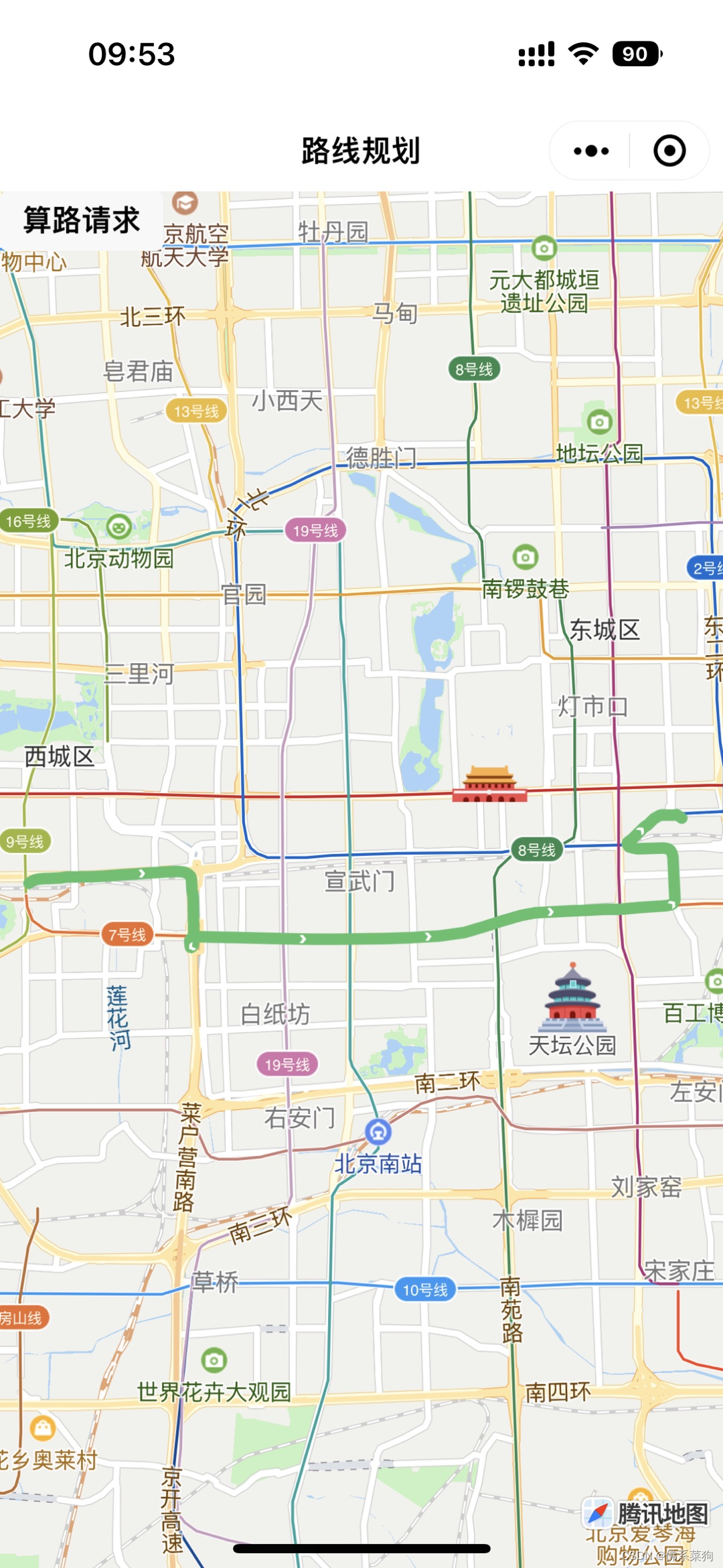
示例2:驾车路线规划
index.wxml
<!--index.wxml-->
<view class="container">
  <map id="map"
    class="map"
    polyline="{{polyline}}"
    longitude="{{longitude}}" latitude="{{latitude}}">
  </map>
</view>

<button size="mini" bindtap="buttonDriving">算路请求</button>
index.js
// index.js
// 获取应用实例
const app = getApp()

Page({
  data: {
    latitude: 39.909088,
    longitude: 116.397643
  },

  buttonDriving(e){
    var _this = this
    //通过wx.request发起HTTPS接口请求
    wx.request({
      //地图WebserviceAPI驾车路线规划接口 请求路径及参数(具体使用方法请参考开发文档)
      url: 'https://apis.map.qq.com/ws/direction/v1/driving/?key=您的key&from=39.894772,116.321668&to=39.902781,116.427171',
      success(res){
        var result = res.data.result
        var route = result.routes[0]

        var coors = route.polyline, pl = [];
          //坐标解压(返回的点串坐标,通过前向差分进行压缩)
          var kr = 1000000;
          for (var i = 2; i < coors.length; i++) {
            coors[i] = Number(coors[i - 2]) + Number(coors[i]) / kr;
          }
          //将解压后的坐标放入点串数组pl中
          for (var i = 0; i < coors.length; i += 2) {
            pl.push({ latitude: coors[i], longitude: coors[i + 1] })
          }
          _this.setData({
            // 将路线的起点设置为地图中心点
            latitude:pl[0].latitude,
            longitude:pl[0].longitude,
            // 绘制路线
            polyline: [{
              points: pl,
              color: '#58c16c',
              width: 6,
              borderColor: '#2f693c',
              borderWidth: 1
            }]
          })
      }
    })
  }
})
版权归原作者 佛系菜狗 所有, 如有侵权,请联系我们删除。