最近在实际业务中需要实现 雷达探测飞行器的功能:在地图上可能会实时出现多个目标物在移动,需求是要实现多个目标物的实时轨迹 和 目标marker的实现,话不多说直接开始!
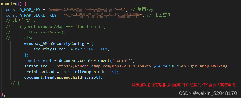
1.步骤一::加载高德地图 Key 申请地址:我的应用 | 高德控制台
2.步骤二:初始化地图
//初始化地图

    initAmap() {
      this.map = new AMap.Map("container", {
          resizeEnable: true,

          center: [114.4293, 30.5162],

          zoom: 12

      });

    //覆盖物的圈圈

        var circle = new AMap.Circle({
          map: this.map,

          center: new AMap.LngLat("114.42935", "30.5162"), //圆心位置

          radius: 4500, //半径 单位:米

          strokeColor: "#1a61d3", //线颜色

          strokeOpacity: 1, //线透明度

          strokeWeight: 3, //线粗细度

          fillColor: "#d3e3fd", //填充颜色

          fillOpacity: 0.35, //填充透明度

        });

        this.manyPersonWays(this.map)   // 最重要的method 方法实现

  },
3.步骤三:功能实现
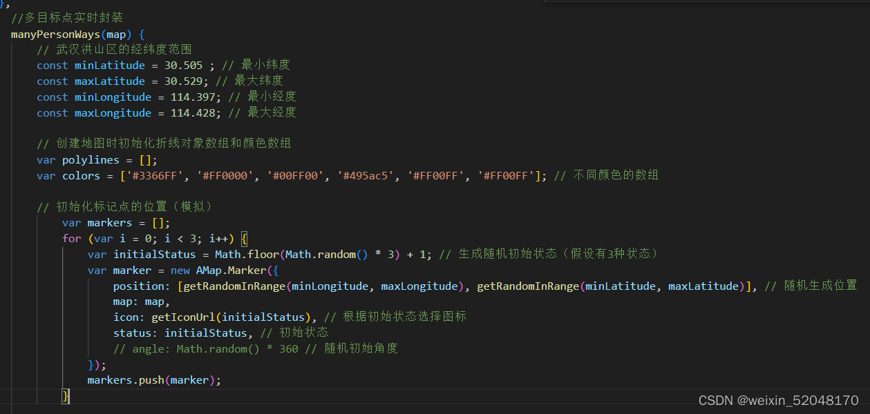
** 一,目标点位数据模拟**

** **
  // 武汉洪山区的经纬度范围 (可以根据你自己的需求调整)

        const minLatitude = 30.505 ; // 最小纬度

        const maxLatitude = 30.529; // 最大纬度

        const minLongitude = 114.397; // 最小经度

        const maxLongitude = 114.428; // 最大经度

        // 创建地图时初始化折线对象数组和颜色数组

        var polylines = [];

        var colors = ['#3366FF', '#FF0000', '#00FF00', '#495ac5', '#FF00FF', '#FF00FF']; // 不同颜色的数组

        // 初始化标记点的位置(模拟)

            var markers = [];

            for (var i = 0; i < 3; i++) {

                var initialStatus = Math.floor(Math.random() * 3) + 1; // 生成随机初始状态(假设有3种状态)

                var marker = new AMap.Marker({

                    position: [getRandomInRange(minLongitude, maxLongitude), getRandomInRange(minLatitude, maxLatitude)], // 随机生成位置

                    map: map,

                    icon: getIconUrl(initialStatus), // 根据初始状态选择图标

                    status: initialStatus, // 初始状态

                    // angle: Math.random() * 360 // 随机初始角度

                });

                markers.push(marker);

            }
二,更新标记位置(也写在 this.manyPersonWays里面)
// 更新标记位置的函数(模拟)
    function updateMarkers(markers) {
        // 模拟每个标记位置的变化
        for (var i = 0; i < markers.length; i++) {
            var marker = markers[i];
            // 模拟标记点每次位置的变化
            var newPosition = [marker.getPosition().lng + Math.random() * 0.01, marker.getPosition().lat + Math.random() * 0.01];
            marker.setPosition(newPosition);
            // 模拟状态的变化
            // marker.status = (marker.status % 3) + 1; // 假设有3种状态
            // 更新折线路径并指定颜色
            updatePolylinePath(marker, colors[i]);
            // 更新标记图标
            updateMarkerIcon(marker);
        }
    }
三,更新图标 (可根据自己需求调整 因为是多个目标所以需要多个图标展示不同状态)
   // 更新标记图标
    function updateMarkerIcon(marker) {
        // 获取当前marker的状态
        // console.log(marker.w.status,'marker');
        // 根据状态设置不同的图标
        // marker.setAngle(marker.w.angle);
        marker.setIcon(getIconUrl(marker.w.status));
    }
        // 根据状态获取图标 URL
    function getIconUrl(status) {
        switch (status) {
            case 1:
                return 'static/yellow.png'; // 黄色图标 URL
            case 2:
                return 'static/blue.png'; // 蓝色图标 URL
            case 3:
                return 'static/perpul.png'; // 紫色图标 URL
            default:
                return 'static/blue.png'; // 默认图标 URL
        }
    }
四,开始绘制点标记的轨迹 并且展示不同的颜色
// 绘制标记点的路线并指定颜色
function updatePolylinePath(marker, color) {
    var path = []; // 折线路径数组
    if (marker.previousPosition) {
        // 如果存在上一个位置,则绘制从上一个位置到当前位置的折线
        path.push(marker.previousPosition); // 上一个位置
        path.push(marker.getPosition()); // 当前位置

        // 在路径数组中添加起点和终点
        var startPoint = path[0];
        var endPoint = path[path.length - 1];
        path.unshift(startPoint); // 添加起点
        path.push(endPoint); // 添加终点

        // 创建折线对象,并指定颜色和箭头标记
        var polyline = new AMap.Polyline({
            map: map,
            path: path, // 折线路径
            strokeColor: color, // 指定颜色
            strokeOpacity: 1,
            strokeWeight: 3,
            strokeStyle: 'solid',
            strokeDasharray: [10, 5],  // 线样式为虚线
            showDir: true // 显示箭头标记
        });

        // 将折线对象添加到数组中
        polylines.push(polyline);
    }

    // 更新标记点的上一个位置
    marker.previousPosition = marker.getPosition();
}
五。模拟实时数据更新的操作(可以改成接口数据 更新)
// 生成指定范围内的随机数
function getRandomInRange(min, max) {
    return Math.random() * (max - min) + min;
}

// 每秒更新标记位置
setInterval(function() {
    updateMarkers(markers);
}, 1000);
版权归原作者 fwf_haohaoxuexi 所有, 如有侵权,请联系我们删除。